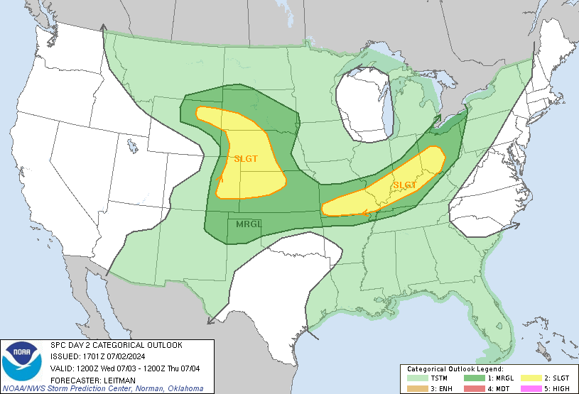
It'll end up being East of the turnpike, ill bet $100 on that.
Announcement
Collapse
No announcement yet.
May Severe Weather
Collapse
X
-
Originally posted by wsushox1 View PostWe don't need a new thread for every event. Use the May severe weather thread.
Comment
-
LCL's going to be super high due to strong surface heating. Iowa would be the place to be (or not be) tomorrow. The hodographs do look decent, but how many times do you get tornadoes with LCL's of 1250-1500 meters? Not very often.The mountains are calling, and I must go.
Comment
-
SPC throws up a day 2 moderate risk.
Tornado threat to exist in Iowa and anywhere along dryline where SFC winds can maintain SErly and Cloud Bases are low.
SPC uses strong language. Could be headed towards a high risk day for Iowa into Central KS.
...MID-MO VALLEY/CNTRL PLAINS...
AN UPPER-LEVEL TROUGH WILL MOVE ACROSS THE FOUR CORNERS REGION
SUNDAY AS DIFFLUENT SOUTHWEST MID-LEVEL FLOW REMAINS IN PLACE ACROSS
THE CNTRL STATES. AT THE SFC...A COLD FRONT WILL ADVANCE SEWD ACROSS
THE CNTRL PLAINS AS A WARM FRONT MOVES NWD ACROSS THE MID MO VALLEY.
A CLUSTER OF THUNDERSTORMS MAY BE ONGOING IN THE MID MO VALLEY
SUNDAY MORNING ON THE NOSE OF THE LOW-LEVEL JET. HOWEVER...MOST OF
THE WARM SECTOR SHOULD REMAIN UNDISTURBED THROUGH EARLY SUNDAY
AFTERNOON AS MODERATE TO STRONG INSTABILITY DEVELOPS. BY LATE
AFTERNOON...NUMEROUS THUNDERSTORMS SHOULD INITIATE ALONG THE WARM
FRONT FROM IA EXTENDING SWWD ALONG THE COLD FRONT INTO SE NEB AND
CNTRL KS. DUE TO THE VERY UNSTABLE AIRMASS...STRONG DEEP LAYER SHEAR
AND IMPRESSIVE LOW-LEVEL SHEAR...AN OUTBREAK OF SEVERE STORMS WITH
MANY TORNADOES WILL BE POSSIBLE ACROSS THE REGION SUNDAY AND SUNDAY
NIGHT.
FORECAST SOUNDINGS FOR 00Z/MON ACROSS THE MODERATE RISK AREA FROM
DES MOINES IA SWWD TO TOPEKA KS SHOW IMPRESSIVE SHEAR PROFILES
COUPLED WITH STRONG INSTABILITY. THE NAM IS FORECASTING MLCAPE IN
THE 2000 TO 3000 J/KG RANGE WITH 0-6 KM SHEAR OF 40 TO 50 KT. IN
ADDITION...LONG LOOPED HODOGRAPHS RESULT IN 0-3 KM STORM RELATIVE
HELICITIES OF 350 TO 500 M2/S2 SUGGESTING THE ENVIRONMENT WILL BE
FAVORABLE FOR SUPERCELLS AND TORNADOES. SEVERAL STRONG OR LONG-TRACK
TORNADOES APPEAR POSSIBLE ACROSS THE REGION AS THE LOW-LEVEL JET
RAPIDLY BECOMES FOCUSED LATE SUNDAY AFTERNOON INTO SUNDAY EVENING.
SUPERCELLS SHOULD BE ACCOMPANIED WITH LARGE HAIL AND WIND DAMAGE.
HAILSTONES GREATER THAN 2 INCHES IN DIAMETER WILL BE POSSIBLE WITH
THE MORE DOMINANT SUPERCELLS.Last edited by wsushox1; May 10, 2014, 01:47 PM.The mountains are calling, and I must go.
Comment
-
What odd is Wichita office was downplaying the risk and mocking the low level shear and were more focused on the rain potential.Originally posted by wsushox1 View PostSPC throws up a day 2 moderate risk.
Tornado threat to exist in Iowa and anywhere along dryline where SFC winds can maintain SErly and Cloud Bases are low.
SPC uses strong language. Could be headed towards a high risk day for Iowa into Central KS.
Comment
-
Things really came together in the models the last 36 hours or so. We do owe DOFO an apology, however, boasting about being right is in poor taste.Originally posted by SB Shock View PostWhat odd is Wichita office was downplaying the risk and mocking the low level shear and were more focused on the rain potential.The mountains are calling, and I must go.
Comment
-
You mean that we are all assholes or there his a high threat of tornado's tomorrow? I get that Fever can be a bit over the top at times, but don't lump us all together please. I, for one, haven't been an asshole...yet today, but there is still daylight left.Originally posted by DanielBryan View PostI hate to say I told you so, but I TOLD YOU SO
Comment


Comment