Announcement

Collapse
No announcement yet.

Severe Weather - Wed (5/12/10)

Collapse
X
 
  • Filter
  • Time
  • Show
Clear All
new posts

  • Severe Weather - Wed (5/12/10)

    Wednesday is the next big day (though Tuesday there could be some elevated hailers).
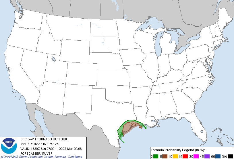


    It is a slight risk that could be a possible Moderate risk day.


    edit note: updated graphic

  • #2
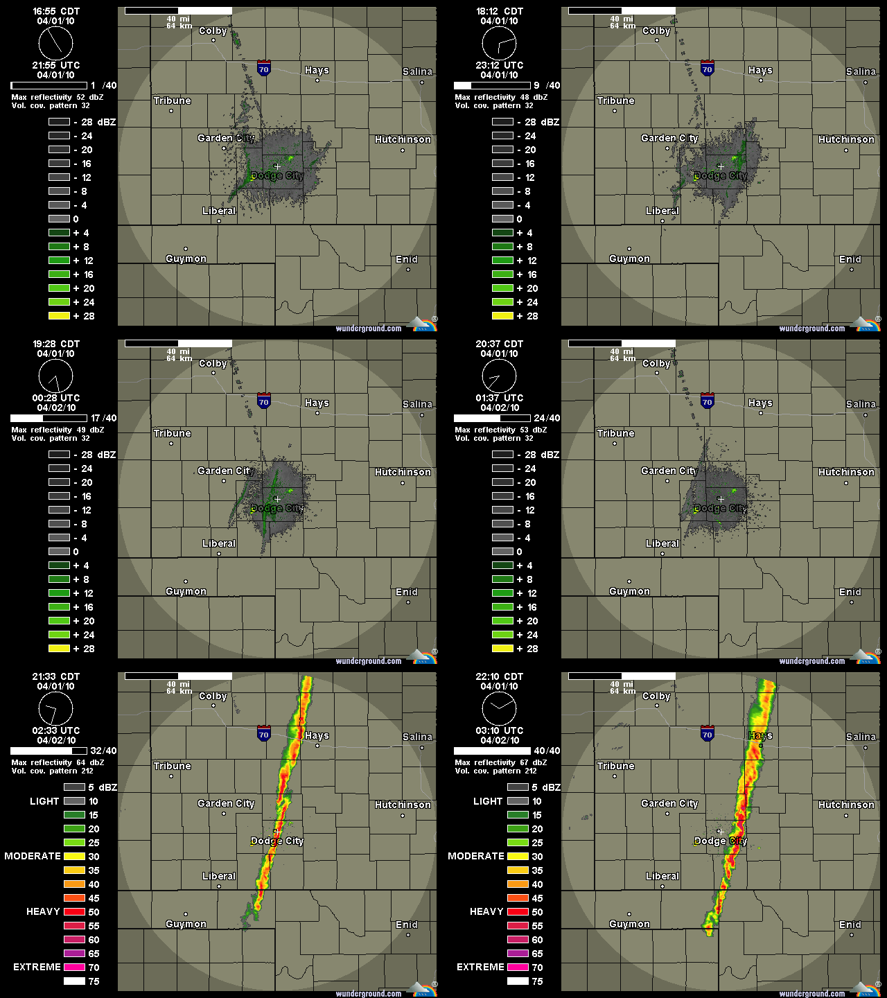
    The pretty powerful cold front over taking the Dryline should be the start of convection in Central KS. Considering this, a linear storm mode would be the type of storms.

    Basically like this. To the left you see an advancing cold front colliding with a retreating dryline.


    This image is from April 1, 2010 of some pretty powerful hailers in Western KS.

    The mountains are calling, and I must go.

    Comment


    • #3
      Still a slight risk though the Tornado or Hail probabilities are just below the MODERATE risk categories.

      It looks like this will be another timing issue. Wichita will either be just east or west of the storms.

      Note: First storms SW of Wichita have fired up.

      Comment


      • #4
        Tornado Watch Up till 10pm for the Wichita area.

        Comment


        • #5
          Storms fired up FAST along the dryline (at least, it looked like the dryline according to surface obs) over Reno and Kingman counties. Severe T-storm warning followed.

          Comment


          • #6
            "AT 349 PM CDT...NATIONAL WEATHER SERVICE METEOROLOGISTS WERE TRACKING
            A CONFIRMED TORNADO. THIS TORNADO WAS LOCATED 6 MILES EAST OF
            INMAN...OR 8 MILES SOUTH OF MCPHERSON...MOVING NORTHEAST AT 45 MPH."

            Comment


            • #7
              4.25" diameter hail at Elyria :shock:

              Comment


              • #8
                Originally posted by BenWSU
                4.25" diameter hail at Elyria :shock:
                Droppin' softballs near McPherson.

                "You Just Want to Slap The #### Outta Some People"

                Comment


                • #9
                  Well the coldfront caused Initiation along the Dryline Like I expected lol. Quickly became Linear as shear was more Parallel with the storm so I don't think we will see much of a tornado threat from here on out.
                  The mountains are calling, and I must go.

                  Comment


                  • #10
                    As those storms become more isolated on the southern end, if they were to be able to become right turners then we could be talking about tornadoes.
                    The mountains are calling, and I must go.

                    Comment


                    • #11
                      Once again the Wichita TDWR radar is down :(. Vance AFB radar in GrLevel3 (VIL) is showing a nice core to the southwest of Wichita. Hail estimated at 2.25". The core by Colwich seems to be collapsing.

                      Comment


                      • #12
                        Originally posted by twister17e
                        Once again the Wichita TDWR radar is down :(. Vance AFB radar in GrLevel3 (VIL) is showing a nice core to the southwest of Wichita. Hail estimated at 2.25".
                        I know I tried getting on that Radar in GRl3 and it was down AGAIN.
                        The mountains are calling, and I must go.

                        Comment

                        Working...
                        X